Detail View: Maps of Africa: Niuewe Kaart van Caap der Goode Hoop in hare rechte jegenwoordige staat vertoond door ...
|
Title:
|
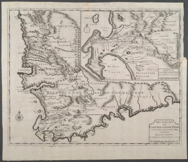
Niuewe Kaart van Caap der Goode Hoop in hare rechte jegenwoordige staat vertoond door ...
|
|
Title in Translation:
|
New map of the Cape of Good Hope.
|
|
Publication Place:
|
Amsterdam
|
|
Publisher:
|
van Braam, J. and onder de Linden, G.
|
|
Publication Date:
|
1724-1726
|
|
Cartographer:
|
Valentijn, Francois, 1656-1727
|
|
Height:
|
44 cm.
|
|
Width:
|
56 cm.
|
|
Scale:
|
Scale in Dutch miles
|
|
Color:
|
Uncolored
|
|
Descriptive Notes:
|
Inset: Detail of the Cape Peninsula with names of farms and their owners. Top right: No. 43. This map "served as a source for other map makers over a number of years."
|
|
Provenance:
|
Dr. Oscar I. Norwich
|
|
General Area:
|
Africa
|
|
Geographic Focus:
|
Cape of Good Hope
|
|
Period:
|
18th c.
|
|
Norwich Number:
|
214
|
|
Call Number:
|
NOR 0214
|
|
Source:
|
Valentijn's Oud en Nieuw Oost Indien, vol. 5 (1724-1726)
|
|
References:
|
Norwich (2nd ed.), ckey = 3871463
|
|
Page:
|
map 0214, p. 241
|
|
Program:
|
Jacobson Africana Program
|