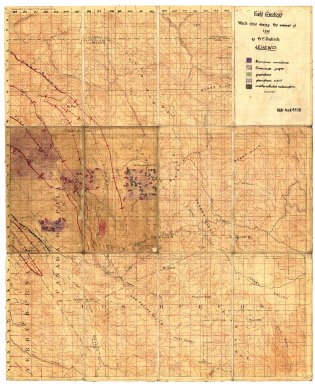
Detail View: Stanford Geological Survey: California, Mt. Hamilton sheet:
|
Title:
|
California, Mt. Hamilton sheet:
|
|
Primary Creator:
|
Dietrich, W. F.
|
|
Date:
|
1912
|
|
Coordinates:
|
(W 121°45'00"--W 121°30'00"/N 37°30'00"--N 37°15'00").
|
|
Scale:
|
Scale 1:62,500.
|
|
Dimensions:
|
45 x 37 cm.
|
|
Notes:
|
18 field notebooks on "San Jose quadrangle" record.; Accompanied by 19 field notebooks.; Annotated and hand colored copies of U.S. Geological Survey Mt. Hamilton quadrangle 1:62,500.; Dietrich text on "Quarry area geology and topography" record.; Relief shown by contours and spot heights.; Sheet 19 includes 2 cross sections.
|
|
Alternate Title:
|
California Mount Hamilton sheet; Mt. Hamilton sheet, California
|
|
Related Items:
|
Maps by: [1] A.W. Ambrose -- [2] R.E. Anderson -- [3] H.M. Andreen -- [4] George Casper Branner -- [5] Logan Burrell -- [6] H. Crandall -- [7] W.F. Dietrich -- [8] B.E. Erb -- [9] A.D. Fyfe -- [10] W.C. Gehrmann, partner R.J. McCann -- [11] M.L. Hall -- [12] W.C. Hammon -- [13] Olaf Jenkins -- [14] G.B. Lantz -- [15] B.H. Lasky -- [16] W.R. Nobs -- [17] A.W. Peake -- [18] A.E. Remington -- [19. Anonymous, showing] Schist -- [20] E.J. Stewart -- [21] E.C. Templeton.
|
|
Subjects:
|
Alameda County (Calif.) -- Maps, Manuscript; Alameda County (Calif.) -- Maps, Topographic; Geology -- California -- Alameda County -- Maps; Geology -- California -- Santa Clara County -- Maps; Santa Clara County (Calif.) -- Maps, Manuscript; Santa Clara County (Calif.) -- Maps, Topographic
|
|
Catalog Key:
|
4250369
|